Wednesday NJ weather: Spotty showers, but not a soaking (yet)
The Bottom Line
We. Need. Rain.
It is important to keep wet, inclement weather in perspective. The past three month stretch has been unseasonably dry (and hot), raising wildfire and drought alarm bells. So it would be wonderful to get a couple more rounds of healthy soaking rain soon.
And I'm happy to say that's exactly what is in the forecast.
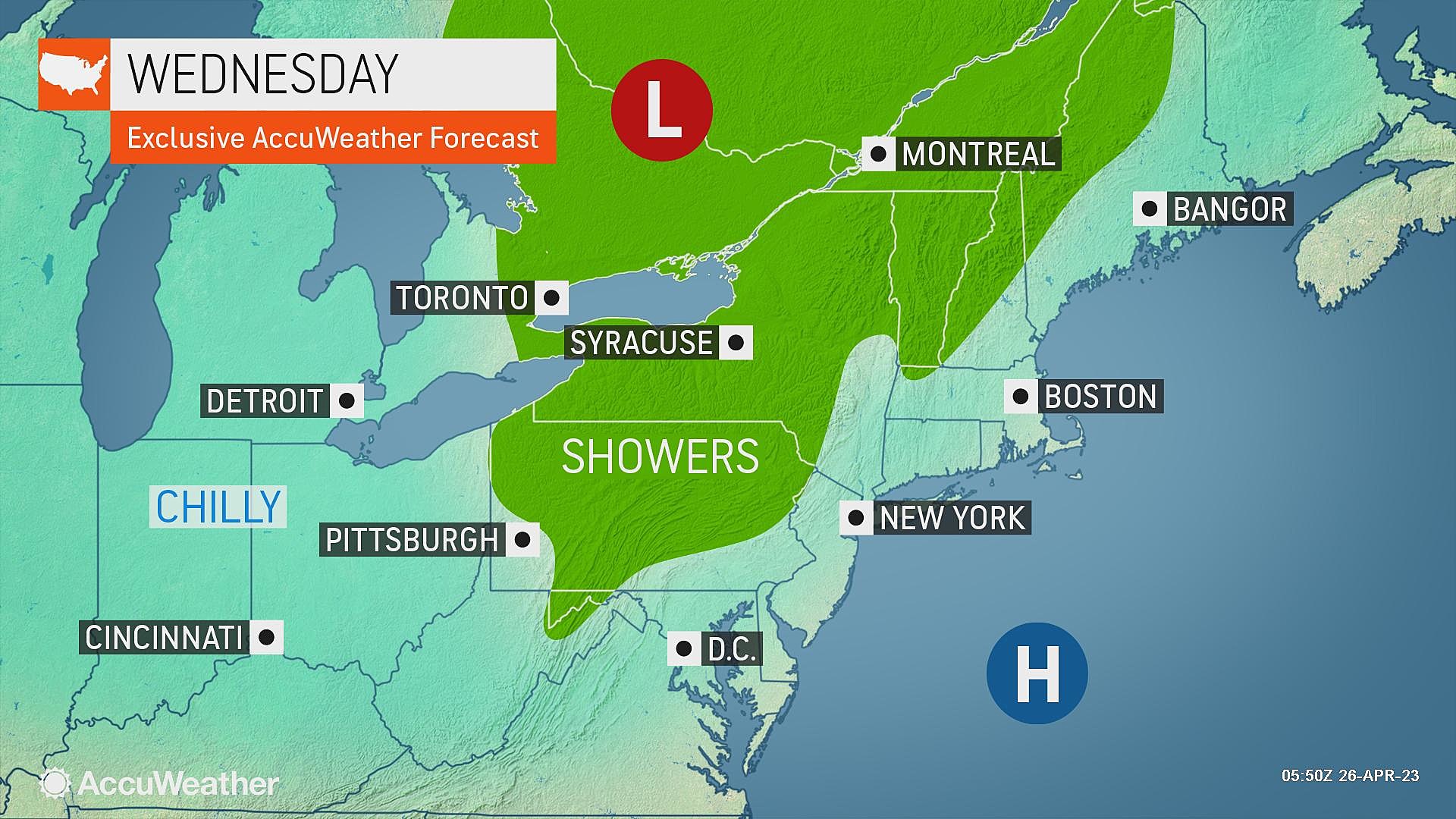
Wednesday will be a bit unsettled, with sprinkles and showers and maybe even a thunderstorm. But rainfall totals will stay below a half-inch.
Thursday will be a mainly dry weather day.
Then Friday could be a washout, with steady rain potentially lasting through the first half of Saturday.
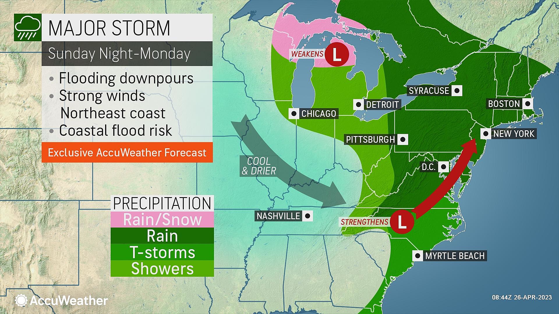
Sunday into Monday presents another chance for heavy rain. And possibly some gusty thunderstorms.
Over the course of the next week, much of New Jersey could pick up 1 to 3 inches of total rainfall. Love it.

Wednesday
It will be another cool late April day. Just like the first half of this week, morning temperatures are in the chilly 30s and 40s. Afternoon high temperatures will reach about 60 degrees, give or take.
But there are some notable changes in Wednesday's weather, as a weak disturbance crosses New Jersey's atmosphere.
As of this writing (6 a.m.), a batch of light showers (sprinkles) is lapping up against the western edge of New Jersey. It's mainly rain, although there are probably some snowflakes flying around Sussex County with temperatures right around the freezing mark. (That is unusual, but not unheard of here in late April.)
Wednesday will not be a washout. In fact, I am optimistic you will find some glimmers of sun.
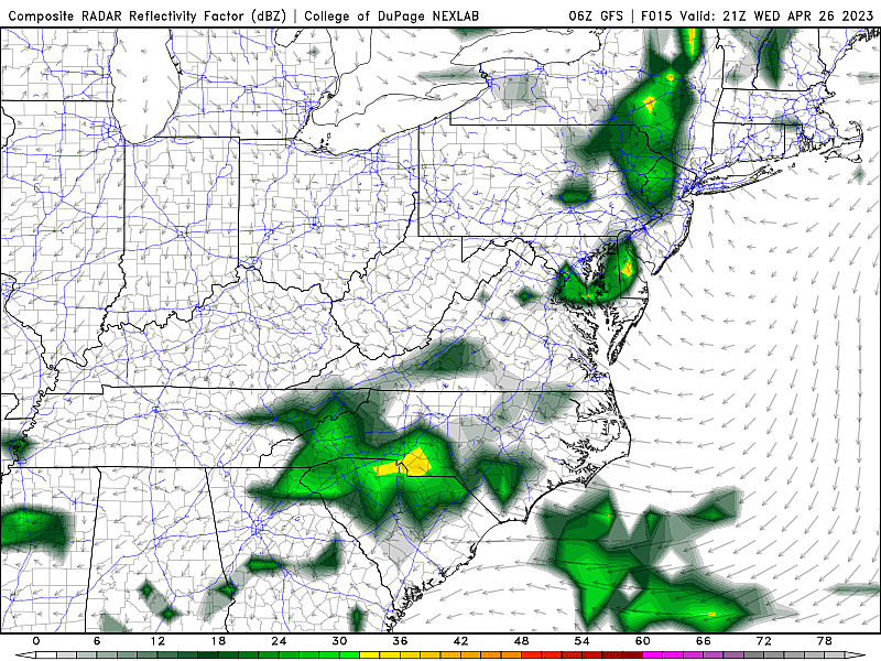
The best chance of widespread rain will come in the afternoon and evening hours. Spotty showers, maybe a thunderstorm, maybe a pocket of pouring rain. Nothing crazy — the risk of severe/dangerous weather is low.
Showers, clouds, and overall dampness will probably linger through Wednesday night. There is no danger of a freeze — low temperatures will bottom out in the mid 40s or so.
Thursday
Mainly, if not totally, dry. And mainly, if not totally, pleasant.
I do have to leave in a shower chance through about mid-morning Thursday. But the rest of the day looks fine. Expect a mix of sun and clouds, pushing high temperatures into the lower 60s.
Friday
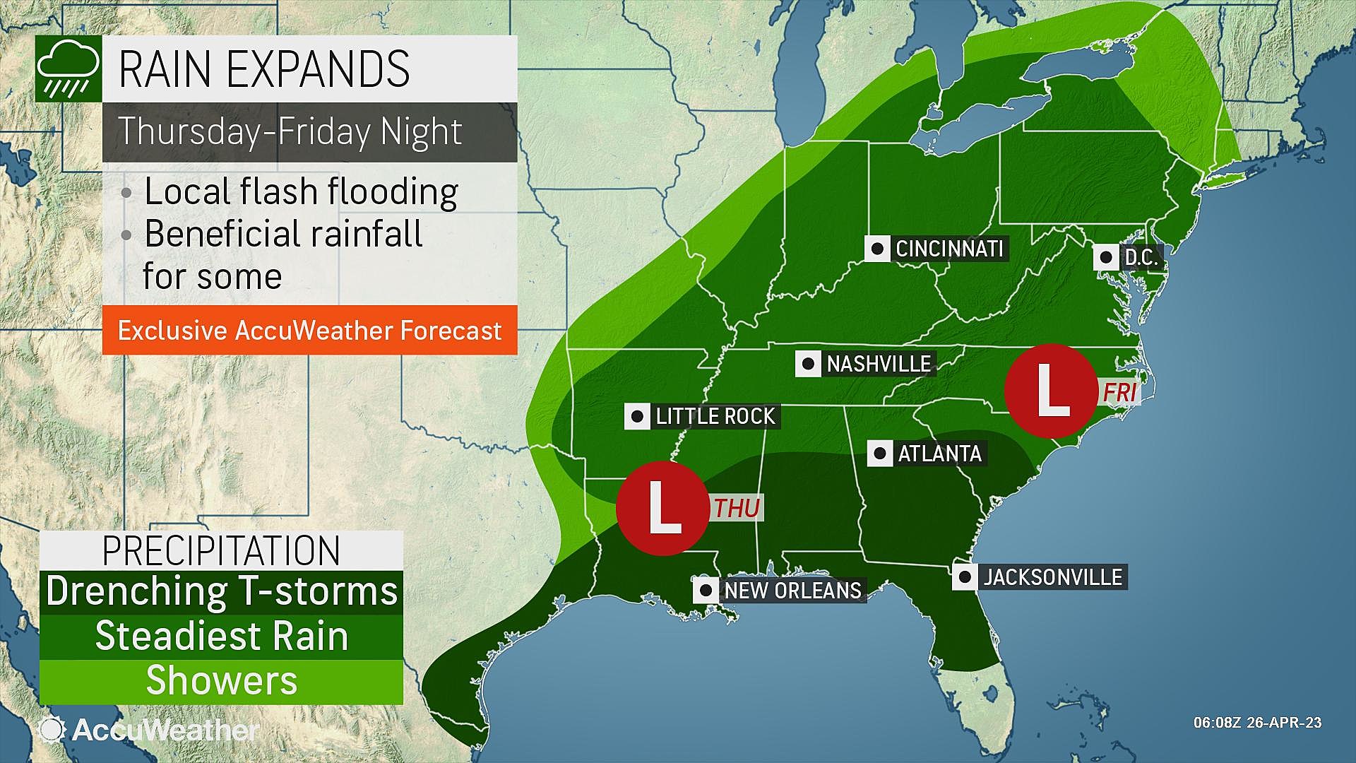
Our second of three storm systems between now and the end of April. And this one may bring a washout to close out the workweek.
There are still some timing difficulties in this forecast — i.e. I can't tell you exactly when the rain will start, when it will be heaviest, and when it will taper off. (I prefer an "all day" solution, for the record.) Overall, Friday looks wet, cloudy, breezy, and cool overall. High temperatures will only reach the 50s.
Between Friday and Saturday, we'll likely see a widespread 1 to 2 inches of rainfall. That's enough to warrant concerns over ponding (big puddles) on roadways, slick conditions, and reduced visibility. Hence the "yellow alert" icon on my 5 Day Forecast.
Saturday
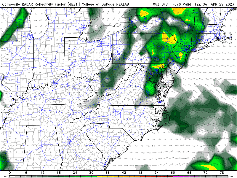
Latest model guidance suggests that Friday's rain may linger through at least Saturday morning too. If we eke out a dry period this weekend, it would be Saturday afternoon — but even that's not a guarantee.
Therefore, if you have outdoor plans for this weekend, you'll want to keep a close eye on the forecast and current weather conditions.
High temperatures on Saturday will once again get stuck in the 50s, due to the raindrops, cloud cover, and a stiff on-shore (easterly) breeze.
Sunday & Beyond
One more storm system is aiming for New Jersey at the tail-end of the weekend. And it could be the strongest and most impactful of all.
I am highly confident it is going to rain again between late Sunday and early Monday. Possibly over an inch.
But once again, the exact rain timeline is hazy. And the storm track is a challenge too. This one could take a coastal storm (nor'easter) trajectory up the Atlantic seaboard. If it does, the door would be open for heavy rain, gusty thunderstorms, and possibly some coastal flooding.
Once we get past the wet start to May, things will settle down next week. At the moment I would call for seasonable temperatures and only occasional showers through next next weekend.
Dan Zarrow is Chief Meteorologist for Townsquare Media New Jersey. Follow him on Facebook or Twitter for the latest forecast and realtime weather updates.
Even more cutest pets in New Jersey — 2023
LOOK: 25 must-visit hidden gems from across the US
More From 97.3 ESPN